Changwon
A port city, Changwon is bordered by Masan Bay to the south, and the cities of Busan and Gimhae to the east. The city of Miryang lies to the northeast, and Jinju to the west.
The region has been inhabited since the Bronze Age, and its urban areas have been renamed and re-organized many times throughout history. In 1974, with the creation of the Changwon National Industrial Complex, the three historically interdependent cities of Masan, Jinhae, and Changwon began to undergo significant economic development, growing into an important industrial centre. On 1 July 2010, the cities of Changwon, Jinhae, and Masan merged to form the current city of Changwon.
As Korea's first planned city, modeled after Canberra, Australia, Changwon uses accessible urban planning including many parks and separate residential and industrial areas. The city has also branded itself an "environmental capital" with the municipal government actively participating in climate change conferences and committing to the development of sustainable policies like the globally recognized bike-sharing program, Nubija.
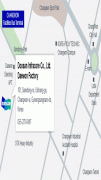
Map - Changwon
Map


Country - South_Korea
 |
 |
| Flag of South Korea | |
The Korean Peninsula was inhabited as early as the Lower Paleolithic period. Its first kingdom was noted in Chinese records in the early 7th century BCE. Following the unification of the Three Kingdoms of Korea into Silla and Balhae in the late 7th century, Korea was ruled by the Goryeo dynasty (918–1392) and the Joseon dynasty (1392–1897). The succeeding Korean Empire (1897–1910) was annexed in 1910 into the Empire of Japan. Japanese rule ended following Japan's surrender in World War II, after which Korea was divided into two zones; a northern zone occupied by the Soviet Union and a southern zone occupied by the United States. After negotiations on reunification failed, the southern zone became the Republic of Korea in August 1948 while the northern zone became the communist Democratic People's Republic of Korea the following month.
Currency / Language
| ISO | Currency | Symbol | Significant figures |
|---|---|---|---|
| KRW | South Korean won | â‚© | 0 |
| ISO | Language |
|---|---|
| EN | English language |
| KO | Korean language |